|
Welcome
to Maryland American
History and Genealogy Project
we are in the process of
building new State and County pages for the states where
the coordinator has moved on to other projects.
Dorchester County is looking for a new Coordinator would you
be interested? If so please contact
Webmaster.
Many of the present coordinators are always willing to give help and
suggestions to newcomers, you can learn, I did and that was after 60!!
Read our
About Page and see what our requirements are,
pretty easy!

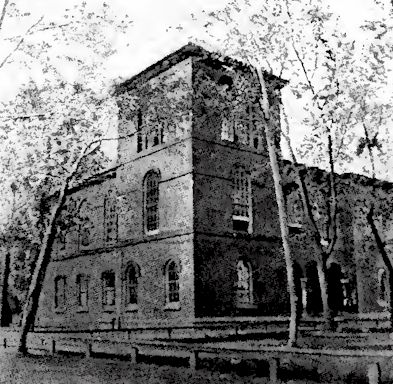
Court House at
Cambridge
Dorchester County is the largest on the Eastern shore,
having an area of 610 square miles, and ranks fourth in
point of size in the State. The Great Choptank River and
Caroline form its northern boundary, and it has a few
miles of eastern border on the Delaware line. The
Nanticoke flows along the southeastern border, and on
the south and west arms of the Chesapeake and the Bay
itself enclose the county.
Dorchester was formed in 1669-70, and its name is traced
to the Earl of Dorset or to Dorsetshire. Various islands
are included in its territory, and the Little Choptank,
the northwest fork of the Nanticoke, Honga, Fishing,
Blackwater, Transquaking, Chickacomico, are rivers and
creeks of Dorchester. Fishing Bay, Tar Bay, Trippe Bay,
Hooper's Straits and other bodies of water add to the
geographical nomenclature of the county. There is a
great extent of marsh land, frequented by myriads of
wild ducks, and oysters, crabs and terrapin abound in
the county waters. Sand, clay and marl make a
diversified soil, and corn, wheat, potatoes, tomatoes
and fruits are grown.
Great quantities of oysters, tomatoes and corn are used
by the packing-houses. The annual income from the oyster
catch is $1,000,000 or more, and Dorchester ranks next
to Somerset in this industry.
Cambridge is the home port of a vast fleet of dredging
and tonging vessels, the seat of large packing
establishments, of shipyards and other manufactures. The
Cambridge and Seaford and the Baltimore, Chesapeake and
Atlantic Railroads traverse northeastern Dorchester, and
steam and sailing vessels reach all parts of the county
lying on water. Cambridge, the county seat, with a
population of 5,747, has a fine salt-water situation on
the Great Choptank, 18 miles from its mouth. The river
here, between the Dorchester and Talbot shores, is
several miles in width, and the town is built on level
ground, extending to the water's edge. The streets are
well shaded, and brick and stone structures predominate
in the business section.
East New Market is in the midst of a thriving
agricultural section, has a population of 1,267, and
Secretary (on Secretary Sewell's Creek), Hurlock,
Williamsburg, Salem, Taylor's Island, Bucktown, Linkwood,
Dailsville, are some Dorchester villages. Vienna, on the
Nanticoke, was long noted for its shipyards, and many
swift and shapely ocean-going vessels were built there
before sceam and iron supplanted wood, and when the
white oak forests of Dorset still afforded the best
material known in former naval construction. Dorchester
was harried by the British during the War of 1812.
Governor John Henry, first United States Senator from
the Eastern Shore, and William Vans Murray were from
this county.
Online Here or Other Sites
Maryland
AHGP
Source: History of Maryland, by
L. Magruder Passano, Wm. J.C. Dulany Company, 1901.
|